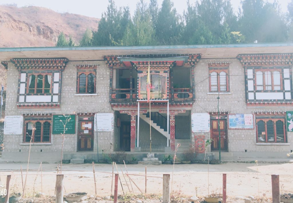
Hungrel
Hungrel Gewog is a gewog of Paro District, Bhutan. In 2002, the gewog had an area of 3.6 square kilometres
| Gewog at glance | Value |
|---|---|
| Number of Chiwogs | 5 |
| Population (Male) | 447 |
| Population (Female) | 451 |
| Households | 156 |
| Gungtongs | 0 |
| Land Area (sq km) | 3.6 |
Sl # | Designation | Name | Gewog/Chiwog | Contact # | Email ID |
1 | Gup | Sherab Lham | Gaupay |
| shearb57@gmail.com |
2 | Mangmi | Kinley Jamtsho | Gaupay |
|
|
3 | GAO | Dorji Tshering | Hungrel |
|
|
4 | Tshogpa | Gyembo | Hungrelkha |
|
|
5 | Tshogpa | Tashi Tshering | Gaupay |
|
|
6 | Tshogpa | Ugyen Tshering | Genkha |
|
|
7 | Tshogpa | Karma Om | Chubjikha |
|
|
8 | Tshogpa | Dema | Lunchuna |
|
|
| Gewog infrastructure | Value |
|---|---|
| Distance (in KM) from Dzongkhag HQ | 6 |
| GC connected with blacktopped road (yes/no) | Yes |
| Access to electricity (number of households electrified) | 146 |
| Access to telecom service (2G/3G/4G/no) | 3G (Chubjikha/Genkha chiog) / 4G (Gaupay/Hungrelkha/Lunchuna) |
| Access to safe drinking water (coverage by %) | 98 |
| 1. RNR | Value |
|---|---|
| Number of RNR centres | 1 |
| Number of irrigation channels by scheme | 5 |
| Number of farm shops | 0 |
| Number of farm machineries (tractors/power tillers, etc.) | 5 |
| Number of vegetable sheds | 0 |
| Number of villages with electric fencing | 2 |
| Number of greenhouse facilities installed | 36 |
| Number of water reservation tanks installed | 2 |
Directory of RNR staff in the gewog
Sl# | Name of service provider | Name | Location | Total staff | Contact # |
1 | Agriculture | Wangmo | Peljorling | 1 |
|
2 | Livestock | Nim Dem | Peljorling | 1 |
|
3 | Forest | Tshewang Nidup | Peljorling | 1 |
|
| 2. Education Services | Value |
|---|---|
| Number of college/Tertiary institutes | |
| Total number of schools | |
| Central school | |
| Higher Secondary school | |
| Middle Secondary school | 1 |
| Primary school | |
| Private schools | |
| Number of ECR | 0 |
| Number of ECCD/ Day care centres | 0 |
| Number of NFE Learning centres | 0 |
Directory of Educational staff in the gewog
Sl# | Name of school | Total no of stds | Name of Principal | Contact # |
1 | Gauphel Lower secondary school | 513 | Jambay |
|
| 3. Health Services | Value |
|---|---|
| Number of Hospitals | 1 |
| Number of BHU | |
| Number of Doctors | 6 |
| Number of Health Workers | 1 (VHW) |
Directory of health staff in the gewog
Sl# | Name of Hospital/ BHU | Location | Total staff | Name of In-charge (s) | Contact # |
1 | Paro hospital | Olathang | 1 | Phurba Tamang |
|
| 4. Community Services | Value |
|---|---|
| Number of community centres (CCs) | 1 |
| Number of virtual Zomdu facility | 1 |
| Bhutan Post | Yes |
| Banking | Yes |
| Insurance | Yes |
Directory of other staffs in the gewog
Sl# | Name of service provider | Name | Location | Total staff | Name of the in-charge | Contact # |
1 | G2C | Phuntsho Wangdi | Peljorling | 1 | Phuntsho Wangdi |
|
| Religious Monuments and Cultural heritages | Value |
|---|---|
| Total number of Dratshang/Lhakhangs | 11 |
| Government-owned Dratshang/Lhakhang | 6 |
| Community Lhakhang | 1 |
| Private Lhakhang | 4 |
| Number of Chortens | 15 |
| Number of pilgrimage sites (neys) | 4 |
| Other (specify) |
Sl# | Gewog Centre | Chiwog | Distance (in KM) from GC |
1 | Peljorling | Genkha | 18 |
|
| Chubjikha | 12 |
|
| Gaupay | 5 |
|
| Hungrelkha | 6 |
|
| Lunchuna | 5 |
| Chiwog at a glance | Value |
|---|---|
| Number of villages | 16 |
| Households not connected with Electricity | 0 |
| Households not connected with Telecommunication | 0 |
| Households not connected with TV | 7 |
| Households not connected with Tapped water | 10 |
| Households not connected with Road | 42 |
| Villages without School | 15 |
| Villages without BHU/ORC | 16 |
Sl # | Chiog Name | Number of | Number of households not connected with | Number of villages without | ||||||
|
| village | Electricity | Telecommunication | TV | Tapped | Road | School | BHU/ORC | |
|
|
|
|
|
|
|
|
|
| |
1 | Chubjikha | 2 | 0 | 0 | 2 | 4 | 0 | 2 | 2 | |
2 | Hungrelkha | 5 | 0 | 0 | 2 | 2 | 10 | 5 | 5 | |
3 | Genkha | 2 | 0 | 0 | 1 | 1 | 0 | 2 | 2 | |
4 | Gaupay | 5 | 0 | 0 | 2 | 1 | 23 | 4 | 5 | |
5 | Lunchuna | 2 | 0 | 0 | 0 | 2 | 9 | 2 | 2 | |
| Total | 16 | 0 | 0 | 7 | 10 | 42 | 15 | 16 | |
Livestock Type | Population |
Local Cattle | Nil |
Improved Cattle | 70 |
Pig (Local & Improved) | Nil |
Poultry (Local & Improved) | 13 |
Sheep | Nil |
Goat | Nil |
Cat | 37 |
Dog | 89 |
Brown Swiss | Nil |
Property | Area in Acres |
Total Area Planted | 67.5 |
Area under forest cover | 1425 |
Grazing Land | …… |
Sokshing Land | ……. |
Private Forest | Nil |
Community Forest | 590 |
Nursery | Nil |
Water Source Protection | 1.5 |
Type of skill (Carpenter etc.) | Village | Number of individuals |
Carpenter | Drukgyeling | 1 |
| Hungrelkha | 1 |
| Jangserbu | 3 |
Embroiderer | Chubjakha | 1 |
Painter | Lungchuna | 1 |
Sculpture | Chubjalha | 1 |
| Nazhikha | 1 |
Stone mason | Nazhikha | 1 |
Grand Total |
| 10 |
Institutions
Staff


Tourism
No tourist destinations in this Gewog.
Quick Links
- Assurance on Accuracy of CV
- Bhutan Computer Incident Response Team (BtCIRT)
- Bhutan NDI
- Bhutan Vaccine System
- G2C eServices – Citizen Services Portal
- Ministry of Health (MoH)
- Online On Application System (Process Citizenship ID Card/Special Permit and Relationship Certificate
- RCSC MAX System
- Security Clearance
- Zhiyog Electronic Systems (ZESt)

